Tongariro National Park

Here is a fairly descent description of the trek from the web:
This pleasant easy walk begins and ends in Ngauruhoe Place, which is situated 100m below Whakapapa Visitor Centre.
The walk has excellent views of Ngauruhoe, Ruapehu and the contrasting vegetation and differing land forms.
The lower track passes through open tussock and alpine shrublands before entering beech forest. On a clear day the symmetrical cone of Mt Ngauruhoe and the older more eroded mountains of Tongariro and Pukekaikiore can be seen.
After entering the mountain beech forest, the track descends to the Wairere Stream, then climbs alongside it, passing the Cascade Falls. The forest consists mainly of large mountain beech trees, shiny broadleaf, mountain five-finger, umbrella ferns and mountain toatoa. Small native birds such as whiteheads, greywarbler and rifleman are commonly seen.
Once the track emerges from the forest it passes over Wairere Stream with impressive views of a small narrow gorge.
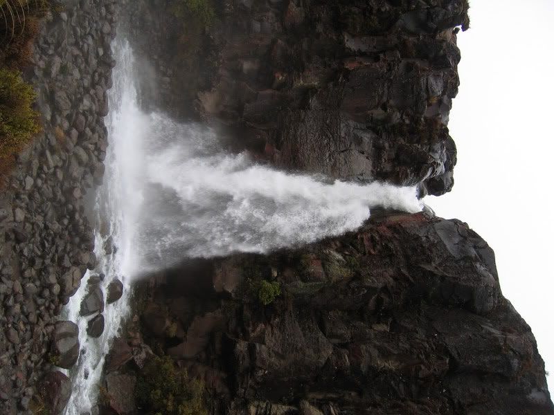
Uphill from here the first view of the Taranaki Falls is obtained, as the Wairere Stream spills over a 20 metre cliff into a boulder ringed pool.
This cliff is the edge of an andesite lava flow, estimated to be 15,000 years old, from a vent on Mt Ruapehu. The Wairere Stream now flows over the lava that originally displaced it, and is slowly eroding a channel through it.
The trail from the falls climbs up through a forest of mountain toatoa before joining the Tama Lakes track. Here the track turns right to cross the water worn rocks of the Wairere stream and climbs the shoulder of the lava flow, now covered with red tussock. Fine views of Mt Ruapehu, The Grand Chateau, and surrounding farm land beyond the Park boundary make this a popular resting point.
Native birds likely to be heard in this area are pipits, fern birds and occasionally sky larks.
Returning towards Whakapapa Village, the track crosses an interesting series of eroded gullies. This erosion is caused by the natural effects of wind, rain and frost action on volcanic soils.
As the trail begins to sidle around the tussock shrub land and the slopes of Mt Ruapehu, it merges with the wider old Waihohonu horse trail. Here, various layers of pumice and ash from previous eruptions are exposed. After passing through the last patch of bush, the track emerges again into red tussock and manuka, leading easily back to Whakapapa Village.
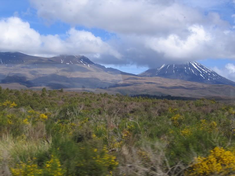
Staying in the National Park (2nd designated park in the world, second to Yellowstone) at an incredible hotel overlooking Ruapehu and Ngauruhoe. A view from around the hotel:
posted by Alyssa Crouse @ 10:00 PM
![]()

1 Comments:
That view is amazing! It makes me want to travel so bad! Sounds and looks like your haveing an incredable time! Miss you!!!
-N
Post a Comment
Subscribe to Post Comments [Atom]
<< Home