Alyssa & Steve's Excellent Adventure

Thursday, November 30, 2006

Lake Wanaka


Dear Mom,


You're going to kill me but...


I just jumped out of a plane!


At 12,000 feet!


Freefalling at 200 km/hr (180 ft/second)!


And I landed safely so don't worry.


Love,


Alyssa


Tuesday, November 28, 2006

Dunedin

Having our own car is so nice. You can venture outside of places, explore smaller roads and really pursue your own interests. Today we took the car out on the peninsula for some wildlife exploration. Saw some amazing birds, moderate quantities of the endagered yellow-eyes penguins and a native New Zealand fur seal rolling around like a blob on the beach.

Dunedin is such a great city, too. The first actual city in New Zealand that I feel like I could spend a considerable amount of time in and not get bored. There's tons of wildlife and a big harbor out the door.

Tomorrow we're going to Wanaka (near Queenstown) for another view of the southern alps and glacier lakes. Will keep you all posted.

Sunday, November 26, 2006

Christchurch and Akaroa

Well, that's it! I'm off on my last week stretch. Met up with Sarah last night in Christchurch for some dinner (good cheap noodles) and a film (called Children of Men, AMAZING but violent).

Today we took a day trip to Akaroa which is on the Banks Peninsula off of Christhchurch. It was a beautiful day and we went for a good hike up to the top to see a view of the entire bay. Good sunny late-spring day with tons of flowers everywhere to smell.

Our itinerary is still a little unclear. We know we're going to Dunedin tomorrow for probably two nights. It's about a 5 hour drive from here. We're going to the Cadbury factory and to see the Albatrosses. Then it's up in the air...either Fjorland and/or Wanaka (near Queenstown) and Mnt Cook. I'll keep you all posted on that, though. By the way, this is all via car for $35/day NZ dollars which is about US$20 or 15 quid. NICE.

Okay, below you can find some pictures from Queenstown that I didn't post yet and some stuff from our trip today.


Botantic Gardens in Queenstown. Hilltop view.


Lake Wanaka, Queenstown.


Botanical Gardens, Queenstown.


Lake Tekapo. About halfway between Queenstown and Christchurch.


Sarah today on our hike that went through a Tree Cropper's garden.


Akaroa bay, low tide.


A heart I made with stones on the beach.


View from the top of Banks Peninsula of Akaroa bay.

Friday, November 24, 2006

Queenstown

In Queenstown now after a bit of a sleep in. We all went out as a group one last time last night didn't get back until quite late. It's really the first time I've stayed out too late in New Zealand...I'm not much for bars but I tried to stay awake for as long as possible last night. Had a big breakfast this afternoon and now I'm going to have a walk around on this gorgeous blue sky day.

Leaving early morning tomorrow for an express to Christchurch, and then meeting Sarah for a week of off-the-beaten-track type traveling. Below are some photos of our travels yesterday:


The view I woke up to in Makarora. Note the rainbow in the background.


Me on the 45th Parallel. This statue marks the latitudinal location between the equator and the south pole.


Our bus on the 45th. It's been great with all of these people to keep me company!


Wednesday, November 22, 2006

Franz Joseph Glacier

Today was one of my best days in New Zealand so far. We took a trip called a Heli Hike where you take a helicopter ride to the top of the glacier and then hike on top of the ice. It can't say that I saw what I expected to see because I've never actually seen a glacier before this. Apparently there are over 3000 glaciers in New Zealand. Franz Joseph is about 11km long and 900 meteres thick. It's advancing in certain places as much as 5-6 meters A DAY during the heavy snowfall months.

The flight was one of the most incredible experience I've ever had...helicopters are so light and compact, so you're basically at the edge of the window the entire flight. There are even windows on the floor that allow the pilot to see the landing space quite clearly. We fit the pilot, myself and 4 others in the cabin and had such a great time being deafened by the noise and giving each other thumbs up for no particular reason.

The glacier was a fantastic sight—a massive sheet of ice that created so many delicious patterns below us. There were gracefull rolling drops and jagged dirty spikes of ice cut dramatically by tiny meandering streams of blue water. The large, spiky shist mountains in the background posed an enormous contrast against the white ice and snow. I kept on expecting to see a polar bear trotting across the snow because the scene was so unreal and remote. Interestingly this particular glacier is located directly beside tempurate rainforest (a very unique occurrence happening only here and in Argentina).

The hike was great—nice and easy in a 2 hour loop track. Ice axes were essential to carve steps on the path we made along the way. We had the opportunity to see excellent transient formations including ice caves and arches. Our guide led us through tiny ice holes and across small streams. This time, without the risk of contracting Giardia, I drank from the pure blue water and releaved my thirst.

Below you can view pictures from my trip along with captions. Next stop tomorrow is further down the west coast, and then Queenstown, so stay posted for info on my last 10 days in this amazing place!


The mighty Franz-Joseph right after our landing.
The highest part of this glacier (not within view here) is connected to a 30km basin that collects massive quantities of snow fall every year and contributes to the glacier formation.


The shoes we wore for agood grip


Me!


Me in a blue ice cave


Hikers on the glacier (gives you some perspective)


The helicopter landing on the glacier


My Stray Travel family in the helicopter


View of the valley from the helicopter (note all the glacier runoff)

Monday, November 20, 2006

Random West Coast Events

Well the West Coast continues to blow me away. We're in Franz Joseph right now and depending on the weather tomorrow I'll take a hellicopter up to the top of the glacier for a hike. Below is a view of the town.


Below you can see a typical South Island bridge from my bus...drivers have to wait on either end and take turns going through the one land bridge. This bridge actually shares the road and the railway, so that's even more exciting. I'm anticipating driving on more bridges like this when I rent a car with Sarah next week.


So a bit shamefully I admit that today I carved bone. I debated whether or not is was ethical but ultimately decided to bite the bullet and do this once-in-a-lifetime activity. I decided to carve a Koru--a very popular Maori symbol. First we traced the symbol that we wanted....


....after much grinding, sanding and polishing I got the end result below. The teachers told me privately that this piece was good enough quality to be sold professionally on the market. Later today I got a compliment from another artist in a stop we made.


The studio we worked in.


Sunset at Barrytown (the only eventful thing there)


________________________________________________
We visited the pancake rocks yesterday. I wish I had more geological information to report for Gabe but I assume they are stratagraphic rocks eroded away by the sea. There are these things they call 'blowholes' that apparently occur very rarely with the tidal fluctuations. I did see it but it was more like water crashing up out of a hole other than any volcanic activity.


Oh, also--we heard that about an hour after we left Wellington on the ferry there was a 5.2 earthquake. Just incase any of you heard about it, I didn't experience it at all. But earthquakes in New Zealand are extremely common anyway. Where we are now, at the Franz-Joseph Glacier, is directly on a subductive fault line of the Pacific Plate and the Astraul-Asia Plate.
More later.

OBLIGATORY PENGUIN CROSSING SIGN PHOTO


Abel Tasman National Park

Well, I'm officially on the South Island now and it's so beautiful I can barely breath sometimes. About 1/4 of New Zealand's population lives here (1 million people), so you can imagine how remote certain places can be, particuarly on the south coast which is where I am right now.

We stayed in Abel Tasman for 2 nights and enjoyed an amazingly sunny and HOT late-spring cloudless day there. I got sunburnt, of course, but oh well. Spent some of my full day on a sailing trip, then hiked a little and took a water taxi back (the only ways to travel through the national park are by foot or on the Tasman Sea).


This is Split Apple Rock.
Don't ask me about how the rock formation came about because I never got an answer.


Me squinting on the boat with Anchorage Bay behind us.


The boat, of course.


View from the early part of my hike.


View of the Tasman sea from one of the highest hike points.


This is weird---the tide from the sea goes out about 1/2 km so they actually drive the water taxis up onto tractors in the water (they have snorkels so they don't flood). The tractor takes the boat all the way along the sand, up a ramp and all the way to the carpark at the information center. That was a really strange ride, sitting in a motor boat while being driven by a tractor.


This is the view from our backpackers, Old McDonald's Farm. They have llamas, peacocks, bulls, dogs, cats, etc. This place was unreal. Apparently they have WWOOFING up the road, and I'll seriously consider working here. There is a community sculpture garden and some great art being made around the area.

Thursday, November 16, 2006

Te Papa

Unfortunately I didn't get to see much of Wellington today because of the awful weather. I almost got thrown into the road last night walking back home when the wind sent two giant refuse recepticles straight at me. I did the whole good citizen thing by gathering up all the glass on the street and trying to reposition the garbage cans but I'm sure it was hopeless...the wind must've taken them all the way down the street.

I spent my entire day in Te Papa--Maori for "Our Place." It's a great museum with tons of interactive exhibitions and educational information about New Zealand. I of course went nuts over the parts that showed the environment before and after human beings showed up here, and ways that people are reintroducing sustainable living back into society. Honestly, I felt quite proud to be a part of that movement in this country and I hope that upon my return here I can work more in areas of conservation. There was a pretty emotional memorial to all the birds, plants, amphibians and invertibrates that have gone extict here, and much information about current species that are threatened.

The place was pretty well designed, but being from America I have a tendency to go to the right instead of the left and sometimes get stuck in opposite traffic flow. I don't know what happened to all the pictures I took today (somehow dissapeared off the camera) but here is one below of species introduced to New Zealand after colonization.


Heading to the South Island tomorrow on ferry via the Cook Strait. It's about a 3 hour ride so hopefully the sea will be friendly in the morning. I'm most likely camping in Abel Tasman National park for 2 nights after that so I don't know when I'll get back to email, but I'll be sure to post asap.

Wednesday, November 15, 2006

The Windy City

DAY 6: Wellington

It's so damn windy here...estimated 150km/hr. Returning to shelter at the flat the MP so generously is letting me stay in. Investigate her further at:
http://www.national.org.nz/MP.aspx?Id=47

Tomorrow is Te Papa (National Museum), Botanical Gardens and Observatory...that is, if I don't get blown away first!

Taking the ferry across to the South Island on Saturday. Will update more later.

Tongariro National Park

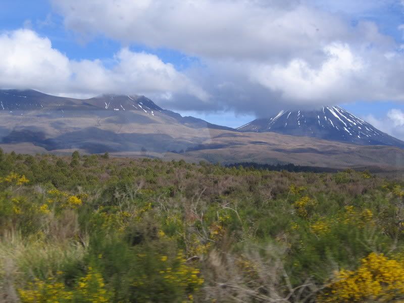
DAY 5: Tongariro National Park
Many chose to do Tongariro Crossing--a walk rated at NZ's best one-day hike at a whopping 17k over a crater and emerald lakes. The weather was quite unfortunate, though, and visibility was no more than 20 meters. Those that did the strenuous hike in my group (mostly VERY unprepared in converse and no rain gear) found it shocking and reported that although they are happy they did the hike, there was such a high wind up at the top they fear for their lives at one point. Additionally, there were none of the view of the volcano Ruapehu or the midlands beyond.
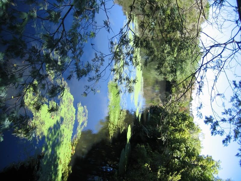
I definitely plan on doing this hike when I get back here, but perhaps in the winter snow with proper gear (it's supposed to be gorgeous). Happily I stayed back and went on a couple of other hikes with some other girls. We took a small hike to Tawhai falls...apparently a Lord of the Rings shooting site (the scene where Golem's brother dies...I don't remember this one)
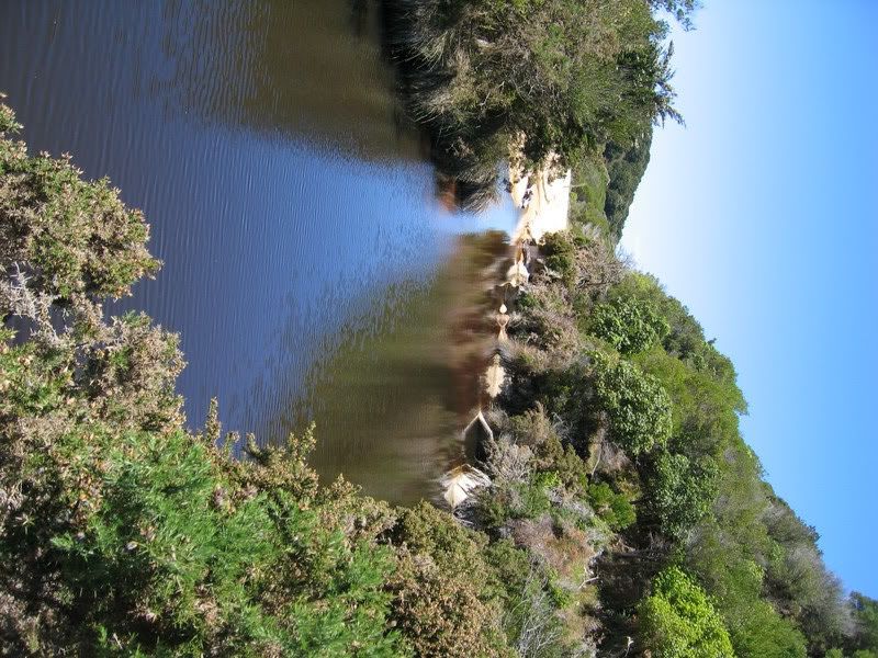
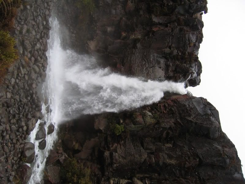
Then we did a 2 hour trek through the volcanic flatlands to Taranaki falls...SO BIG! I wanted a photo with them so I climbed down and got so soaked from about 50 feet away! It was a good hike through some swamplands and really young native bush regrowing after Ruapehu's 1996 eruption.


Here is a fairly descent description of the trek from the web:

This pleasant easy walk begins and ends in Ngauruhoe Place, which is situated 100m below Whakapapa Visitor Centre.
The walk has excellent views of Ngauruhoe, Ruapehu and the contrasting vegetation and differing land forms.
The lower track passes through open tussock and alpine shrublands before entering beech forest. On a clear day the symmetrical cone of Mt Ngauruhoe and the older more eroded mountains of Tongariro and Pukekaikiore can be seen.
After entering the mountain beech forest, the track descends to the Wairere Stream, then climbs alongside it, passing the Cascade Falls. The forest consists mainly of large mountain beech trees, shiny broadleaf, mountain five-finger, umbrella ferns and mountain toatoa. Small native birds such as whiteheads, greywarbler and rifleman are commonly seen.
Once the track emerges from the forest it passes over Wairere Stream with impressive views of a small narrow gorge.
Uphill from here the first view of the Taranaki Falls is obtained, as the Wairere Stream spills over a 20 metre cliff into a boulder ringed pool.
This cliff is the edge of an andesite lava flow, estimated to be 15,000 years old, from a vent on Mt Ruapehu. The Wairere Stream now flows over the lava that originally displaced it, and is slowly eroding a channel through it.
The trail from the falls climbs up through a forest of mountain toatoa before joining the Tama Lakes track. Here the track turns right to cross the water worn rocks of the Wairere stream and climbs the shoulder of the lava flow, now covered with red tussock. Fine views of Mt Ruapehu, The Grand Chateau, and surrounding farm land beyond the Park boundary make this a popular resting point.
Native birds likely to be heard in this area are pipits, fern birds and occasionally sky larks.
Returning towards Whakapapa Village, the track crosses an interesting series of eroded gullies. This erosion is caused by the natural effects of wind, rain and frost action on volcanic soils.
As the trail begins to sidle around the tussock shrub land and the slopes of Mt Ruapehu, it merges with the wider old Waihohonu horse trail. Here, various layers of pumice and ash from previous eruptions are exposed. After passing through the last patch of bush, the track emerges again into red tussock and manuka, leading easily back to Whakapapa Village.

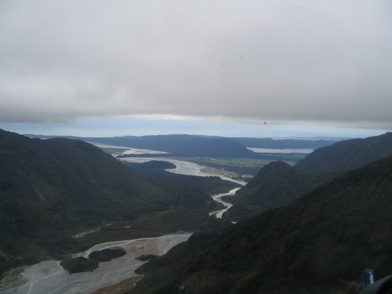
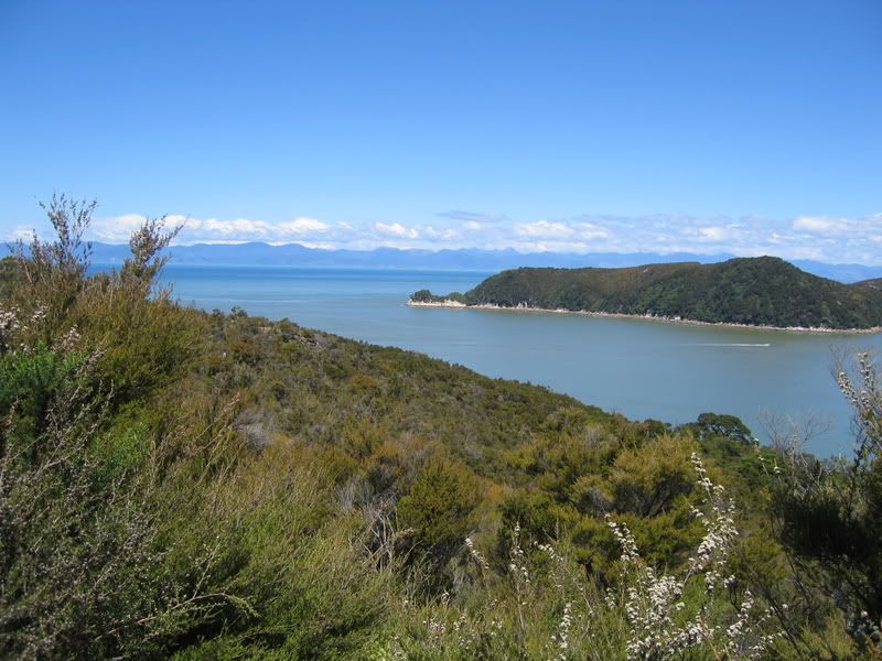
Staying in the National Park (2nd designated park in the world, second to Yellowstone) at an incredible hotel overlooking Ruapehu and Ngauruhoe. A view from around the hotel:


Tuesday, November 14, 2006

Rotorua

DAYS 4 & 5: Rotorua

Yesterday I rafted the biggest commercially rafted waterfall in the world (21 ft drop). The trip, although short, was action-packed and really exhilarating.

Spent the rest of the day wandering around Rotorua in the sunshine along the lake front.


(black swans on the lake)


The entire town smells of eggs as it is so volcanically active and steam pours out of orifices covering the entire city. After some time I came across the government gardens that are so large, expansive and treeless and covered with Pukekos (a native New Zealand bird—black with a red beak and red legs). I found a rose garden with the most wide and open petals in every color—crimson and buttercup and sorbet orange. Behind the rose trellises there stood an extremely tall weeping sequoia, which made me think of my dear friend Marie from Warrior.


Venturing out at night I went with some fellow travellers to the contemporary baths, which were so incredibly relaxing. So far I’ve been to three hot pools in NZ (one on Coromandel, one in Tuaranga on the N. Island's east coast and to now Rotorua’s). By far the Polynesian spa is the classiest, with 4 pools of varying temperatures (ranging from 39-41 degrees Celsius). Today we went to a Maori village on the way out of town which I don’t even want tot talk about because it was so over commercialized. There were a couple of thing, though...the village cooks all their food in Hangi style using the heat from the earth as a source. They have steam boxes around the village that they place their meat in to cook, which takes about 3-4 hours. Below you can see a woman pulling corn wrapped in cheese cloth. The corn takes about 10 minutes in this hot pool which ranges from 90-110 degrees celsius.


The decorative top of a church and meeting house that archetectually represents the human body (door-mouth, windows-eyes, beams are arms and legs).

Now in Taupo for the night (NZ's largest lake—46k. It can fit Singapore in the center of it) Went to a yoga class because I was feeling so antsy on the bus all day. It did relax me a lot but it was a beginner's class so it was a little boring.

Sunday, November 12, 2006

WAITOMO

DAY THREE: Waitomo Caves

Visited the Waitomo Caves and went on a walking tour within some of them and a boat tour in another. When all the light pollution from outside was eliminated the entire cave glowed like the brightest stars I've ever seen, only instead of stars there were thousands of glow worms everywhere. We learned a lot about the geology of the region (so I can report back to Gabe what I learned) and the life cycle of the glow worm.


The rivers around here have tons of freshwater eels so they lured a few out with goat meat and brought them out of the water...really creepy little buggers! All I could think about was that scene from Princess Bride when she gets stuck in the ocean with the giant eels.


Me outside of the cave.

Now in Rotorua for the next two nights.

Saturday, November 11, 2006

Raglan

DAY TWO: Raglan

Our Guide took us to his mother’s in Hamilton for tea this morning and we took a really bizarre mini bush walk in the middle of the city.

We also stopped to hug a Kauri for good luck:


Raglan, which is on the West Coast is a really great town—what they call “Hippie-Surfer” so of course it’s right up my alley. We’re staying in the most perfect little community called Karioi Lodge and Surf School. They run a backpackers type operation and teach surfing but are also working on restoring the native bush. There are little scattered dorms and kitchens and a sauna throughout the property decorated with mosaics and beautiful murals with inspirational messages. They actually take on wwoofers here (where you work for your accommodation) but they’re packed right now. I’m definitely coming back here when I come back for a full year.

That’s something that really hit me today—returning here. I had been talking about it vaguely but today for some reason I finally felt like it is possible a lot sooner than I thought. Wwoofing is a really great way to see the country on a budget as your hosts usually provide both food and accommodation. And I’m a lot more confident about my ability to do good work or the organic community.

Another this I’ve realized here is how much more simple I’ve been living because of a seriously decreased us of electricity (usually none), living with less STUFF and creating less waste. When I got to this community today I said “Thank God” to myself upon seeing the compost bin—yesterday was my first day without compost in 5 weeks!

As I write this entry in my paper journal I’m lying in a hammock and petting a dog while listening to some drunken stranger playing beautiful songs of the guitar down the hill and am so content, so euphoric within this place and all its special nooks and crannies.

I know that this is what my grandparents said they were afraid of—that I would enver want to come back. Well, they were justified in their concerns.

But don’t worry. I’ll be home for Christmas ;)

Alyssa’s Mini-Kiwi Trek

DAY ONE: Coromandel, Hahei, and Hot Water Beach

Day one introduced a bit of dejavu, as we had been at Hahei Beach last week for the Cathedral Cove Kayak. This beach is so clean and pure and empty, so revisiting it was quite a pleasure.

Spend the day basking in the sun and writing messages in the sand. I will post pictures of that later as my camera cable is buried deep within my pack and would be impossible to find at the moment. (CHECK BACK TO THIS ENTRY FOR EDITS AND PHOTOS)

Later that night we went to hot water beach, but this time I was there before sunset so it wasn’t as cold and I didn’t hesitate jumping in. For two hours either side of low tide, you can dig in the sand for hot spring water and make your own spa pool. Hot Water Beach has two fissures issuing water as hot as 64ºC (147ºF) at a rate as high as 15 litres/minute. This water contains large amounts of salt (NOT salt water), calcium, magnesium, potassium, fluorine, bromine and silica. Although I usually dislike being warm, lately I’ve felt that water can’t get hot enough. I’m struck by the initial heat when entering a hot pool but soon after I want it to be hotter and hotter. I have no way to explain this phenomenon.


Some fellow travelers in the hot pools:


A really cool bird called an Oyster Catcher (I don't know its realy name):


We had a nice barbeque followed by much-needed sleep at a backpackers on the beach.